

If you are asking where is Kilimanjaro in Africa, the short answer is this: it sits in northeastern Tanzania, just south of the Kenyan border. People often assume it belongs to Kenya because so many famous photos show it rising behind Amboseli’s elephants. Those photos are taken from the Kenyan side. The mountain itself is in Tanzania.
So, what country is Kilimanjaro in? Tanzania. The peak lies about 205 miles (330 km) south of the equator, near the towns of Moshi and Arusha. At 19,341 feet (5,895 m), it is the tallest mountain in Africa and the tallest free-standing mountain in the world. It is a dormant volcano, made of three cones: Kibo, Mawenzi, and Shira.
Below, we cover the Mount Kilimanjaro location on a map of Africa, the nearest airports and towns, and the quick facts you should know before planning a trip. We are a locally owned operator based in Arusha, and we guide climbers up this mountain every season, so we will point out what matters on the ground too.
Why Kilimanjaro’s location matters for your trip
Knowing where Kilimanjaro is in Africa does more than settle a trivia question. It decides which visa you need, which airport you fly into, what the weather does on summit night, and what else you can fit into the same trip. Here is how the location affects your plans in practice.
The country sets your rules and paperwork
Because the mountain sits in Tanzania, Tanzanian rules apply to every climber. Most visitors, including US citizens, need a tourist visa, and you can usually arrange it online before you fly. Park fees go to the Tanzania National Parks Authority, and they make up a large share of your total climb cost.
Guiding rules matter even more. You cannot climb Kilimanjaro on your own. Tanzania requires a licensed guide and a registered operator, and the whole crew of guides, cooks, and porters is regulated. An operator based in Arusha or Moshi knows the rangers, the gate procedures, and how the weather behaves on each side of the mountain.
Kilimanjaro is in Tanzania, so Tanzanian park rules, fees, and guide requirements shape every climb.
The equator changes what you pack
At roughly 3 degrees south of the equator, Kilimanjaro packs five climate zones into one hike. You start in farmland and rainforest, cross heath, moorland, and alpine desert, and finish on an icy summit. Lowland days can feel like 80°F (27°C), while summit nights can fall to around 0°F (-18°C), so you pack for both.
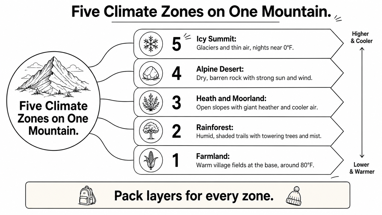
Daylight also stays steady all year. Near the equator, the sun rises around 6:30 a.m. and sets around 6:30 p.m. in every month, so your daily hiking schedule barely changes by season. What does change is rain and cloud, and we cover that in the best-time section below.
Arusha puts safaris and beaches within reach
Most climbers land at Kilimanjaro International Airport (JRO), which sits between Moshi and Arusha. Arusha is also the gateway to the northern safari circuit, so you can pair a climb with game drives without long transfers. We usually suggest climbing first, then recovering on safari or at the beach. Tired legs enjoy a 4×4 far more than a tent.
| Add-on | Typical travel time from Arusha |
|---|---|
| Lake Manyara | About 2 hours by road |
| Tarangire National Park | About 2 hours by road |
| Ngorongoro Crater | About 3 hours by road |
| Serengeti National Park | About 1 hour by flight, or a full day by road |
| Zanzibar | Under 2 hours by flight |
Times are approximate and depend on road conditions and flight schedules. If you want to link the mountain with the Serengeti or Zanzibar, we can build a tailor-made itinerary around your dates and fitness level.
How to find Kilimanjaro on a map of Africa
Once you know the country, the map is easy to read. This section shows you how to spot the mountain on a map of Mt Kilimanjaro in Africa, then confirm it with nearby landmarks.
Start in the northeast corner of Tanzania
Picture the eastern bulge of Africa, then drop just south of Kenya. That is the Mount Kilimanjaro location, in Tanzania’s Kilimanjaro Region, about 205 miles south of the equator. If you ask where Mount Kilimanjaro is located in exact terms, the summit at Uhuru Peak sits at roughly 3.07° S, 37.36° E. Paste those numbers into Google Maps and the pin lands on the roof of Africa.
Kilimanjaro does not belong to a mountain chain. It rises alone from a flat plain, so it is easy to spot on satellite view. Look for a dark green circle with a pale, bare center. That green ring is the forest on the slopes, and the pale center is the crater zone and glaciers around Kibo.
Use nearby landmarks to confirm it
If the map is zoomed out and you are unsure, search for the places around the mountain. The table below gives you reference points, with distances that are approximate straight-line figures.
| Landmark | Position relative to Kilimanjaro |
|---|---|
| Moshi | At the southern foot of the mountain |
| Arusha | About 50 miles (80 km) west |
| Mount Meru | About 45 miles (70 km) west |
| Amboseli National Park, Kenya | Just across the border, about 25 miles (40 km) north |
| Indian Ocean coast | Roughly 175 miles (280 km) east |
Find Moshi and Arusha on the map, and the giant peak sits just east of Arusha and north of Moshi.
Mount Meru is the other big volcano in the area, and it is a common source of confusion. It is shorter at 14,980 feet (4,566 m), and it stands next to Arusha. Kilimanjaro is the taller, broader peak to the east.
Zoom in to see the three cones
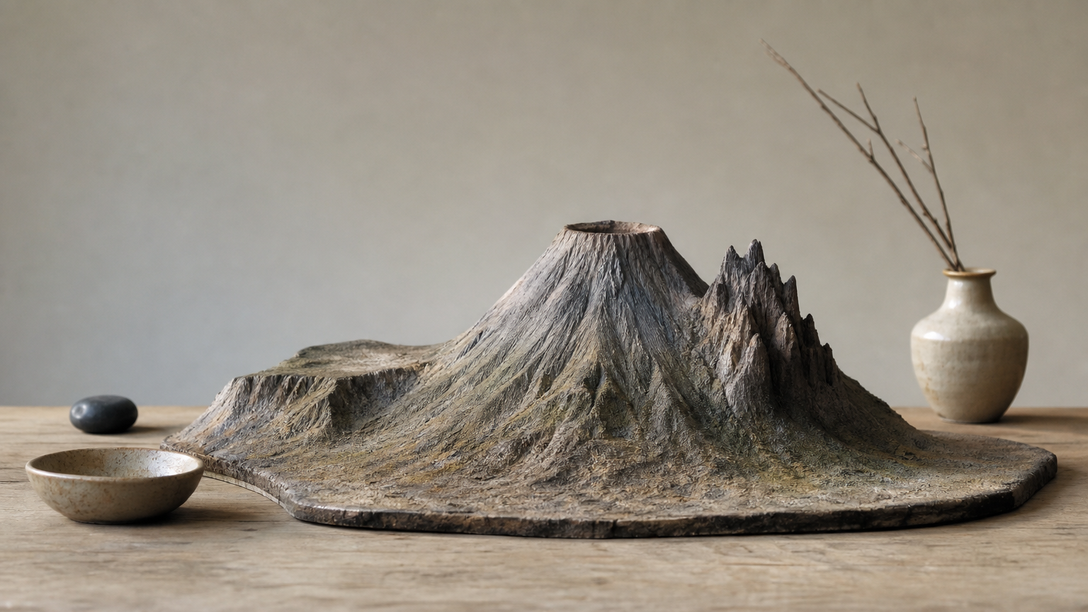
At close range, the map shows what makes the mountain unusual. Kibo is the large central cone with the summit. Mawenzi is the jagged peak to the east, and Shira is the lower, eroded plateau to the west. Most hiking trails climb the south, west, and northeast flanks. The northern slopes face Kenya and are rarely used by climbers, which is why photos from that side feel so different.
How to get to Kilimanjaro from the airport and nearby towns
Getting to the mountain is simple once you know where Kilimanjaro is in Africa and which gateway towns surround it. Most climbers use one airport and one of two bases.
Fly into Kilimanjaro International Airport (JRO)
Kilimanjaro International Airport (JRO) is the closest airport to the mountain. It sits on the plain between Moshi and Arusha, and several international carriers connect to it through Amsterdam, Addis Ababa, and Doha. Most flights land in the evening, so plan on a night in town before you start hiking.
| Trip | Distance | Typical drive time |
|---|---|---|
| JRO to Moshi | About 25 miles (40 km) | 40 to 50 minutes |
| JRO to Arusha | About 31 miles (50 km) | About 1 hour |
| Arusha to Moshi | About 50 miles (80 km) | 1.5 to 2 hours |
| Moshi to Machame Gate | About 18 miles (29 km) | About 40 minutes |
Land at JRO and you are about an hour from a bed in Moshi or Arusha, and within a couple of hours of any trailhead.
Other ways in from Dar es Salaam and Nairobi
If your international flight lands elsewhere, you have a few good options. Each one still ends in Moshi or Arusha.
- Dar es Salaam: Take a domestic flight of about 1.5 hours to JRO. The road trip takes more than 8 hours, so we do not recommend it.
- Nairobi, Kenya: Fly to JRO in about an hour, or take a shuttle bus to Arusha. The bus takes 5 to 6 hours plus border formalities at Namanga.
- Zanzibar: Fly direct to JRO in under 2 hours, which suits climbers who want a beach stay after the summit.
We suggest arriving at least one day before your climb starts. Your guide can meet you at the airport with a name sign, drive you to your hotel, and run a gear check that evening. That buffer also protects you from a delayed bag, which is the most common hiccup we see. Rental gear can fill gaps, but boots you have already broken in are worth the effort to bring.
Kilimanjaro’s key facts: height, volcano type, and eruptions
Most people who search for the Mount Kilimanjaro location also want to know what kind of mountain it is. These are the facts we get asked about most, and the ones that actually affect your climb.
Height and size at a glance
Uhuru Peak on Kibo is the highest point, at 19,341 feet (5,895 m). The mountain is also free-standing, meaning it rises alone from the plain instead of from a range. That is why it looks so huge from Moshi and Amboseli, and why it is counted among the Seven Summits.
| Fact | Detail |
|---|---|
| Summit | Uhuru Peak, 19,341 ft (5,895 m) |
| Rank | Highest in Africa, tallest free-standing mountain in the world |
| Type | Stratovolcano |
| Status | Dormant (Kibo), extinct (Mawenzi and Shira) |
| Last major eruption | About 360,000 years ago |
Volcano type and eruption history
Kilimanjaro is a stratovolcano, built up over roughly a million years from layers of lava, ash, and rock. Three separate cones formed along the way, and each has its own story.
Shira collapsed first and is now a broad, eroded plateau. Mawenzi is also extinct, and its jagged ridges are what remains of the old cone. Kibo is the dormant one. Its last major eruption was about 360,000 years ago, and some evidence points to minor activity within the last few hundred years. Gas vents near the crater still release sulfur, a reminder that the mountain is quiet but not dead.
Kibo is dormant, not extinct, but nothing suggests an eruption is likely during your climb.
What this means for your climb
Because the volcano is calm, the real hazard is altitude, not lava. Standard routes need no ropes or ice axes, since the summit push is a steep walk. But the air at the top holds about half the oxygen you breathe at sea level. We recommend a 7 to 9 day itinerary, because the extra days give your body time to adjust.
Ice is the other fact worth knowing. The summit glaciers have shrunk sharply over the past century, and many scientists expect them to keep retreating. If seeing them is on your list, do not wait too many years.
Where the climb starts and which routes begin there
Knowing where Kilimanjaro is in Africa gets you to the right region. Knowing where the trail starts gets you to the right gate. Here is how the starting points are laid out around the mountain.
Every climb begins at a park gate
Climbs start at a national park gate, not at the airport or in town. The mountain has a ring of gates on its southern, western, and northern sides, and all of them are reached by road from Moshi or Arusha. Your guide registers your group at the gate, the crew checks your permits, and you start hiking from there.
Your route decides your gate, and your gate decides which side of the mountain you see first.
The main routes and their trailheads
The table below shows where each popular climbing route begins and how long it usually takes.
| Route | Side of the mountain | Trailhead | Typical length |
|---|---|---|---|
| Marangu | Southeast | Marangu Gate | 5 to 6 days |
| Machame | South | Machame Gate | 6 to 7 days |
| Umbwe | South | Umbwe Gate | 5 to 6 days |
| Lemosho | West | Londorossi Gate | 7 to 8 days |
| Rongai | North, near the Kenyan border | Rongai trailhead | 6 to 7 days |
| Northern Circuit | West, looping north | Londorossi Gate | 9 days |
Mweka is the exception. It is a descent-only route on the south side, and most climbers use it to come down after the summit. The gates also differ in distance. Machame is the closest to Moshi, while Londorossi and Rongai are about a half-day drive away.
How to choose your starting point
Most of our climbers pick Lemosho or Machame. Lemosho is quieter and its longer schedule gives you better acclimatization, which raises summit success. Machame is busier but scenic, and it suits people who want a solid 7-day plan.
Rongai is the drier choice, and it is the best pick if you climb during the rainy months. The Marangu route is the only one with sleeping huts instead of tents, though its short schedule leaves less time to adjust to altitude. Tell us your fitness level and dates, and we will match you to a route and gate.
Common location mix-ups: Kenya, Amboseli, and the Equator
Even when you know where Kilimanjaro is in Africa, a few persistent mix-ups can send your planning sideways. These are the ones we correct most often.
Kenya and Amboseli: the photo problem
Amboseli National Park in Kenya offers the most famous views of the mountain, with elephants in the foreground and a snowy summit behind them. That is why many travelers assume Kilimanjaro is Kenyan. It is not. The border runs just north of the peak, and every slope and the summit lie in Tanzania.
This has a practical side. You cannot start a climb from Kenya, because no climbing route begins there. Even Rongai, which approaches from the north near the border, starts on the Tanzanian side. If you stay in Amboseli, you can admire the mountain, but you still need to cross at Namanga or fly into JRO to reach a trailhead.
You can photograph Kilimanjaro from Kenya, but you can only climb it from Tanzania.
Some travelers like to combine both countries, and that works well. A Kenya-Tanzania safari can pair Amboseli’s views with a proper climb on the Tanzanian side.
The equator: close, but not on it
People often picture Kilimanjaro sitting right on the equator because of its tropical setting and its glaciers. In reality, the peak is about 3 degrees south, roughly 205 miles from the equator line. The equator crosses Kenya instead, near Mount Kenya, a separate mountain that stands about 200 miles to the north.
Mount Kenya is the second-highest peak in Africa at 17,057 feet (5,199 m). Its climb is more technical than Kilimanjaro’s, so the two are not interchangeable. Mixing them up can lead you to book the wrong gear list, the wrong country, and the wrong season.
Quick reference: myth versus fact
| Common mix-up | The fact |
|---|---|
| Kilimanjaro is in Kenya | It is entirely in Tanzania |
| Kilimanjaro sits on the equator | It is about 3° south, roughly 205 miles away |
| Kilimanjaro is Mount Kenya | They are different mountains, about 200 miles apart |
| Kilimanjaro is Mount Meru | Meru is 14,980 ft (4,566 m) and stands near Arusha |
When you compare quotes from different operators, check that the trailhead, gate, and country match this table. An itinerary that lists a Kenyan start for Kilimanjaro is a red flag, and we would ask the operator to explain it before you pay a deposit.
Best time to visit Kilimanjaro and what to expect
Now that you know where Kilimanjaro is in Africa, timing is the next decision. The mountain sits in northeastern Tanzania, close to the equator, so seasons mean rain, not big temperature swings. Your job is to pick a window with stable trail conditions and clear summit views.
The two dry seasons
Kilimanjaro has two good climbing windows. January to mid-March is warm and mostly dry, with fewer people on the trail. June to October is the longest and most reliable stretch, with the clearest skies and the firmest ground underfoot.
| Period | Conditions | Crowds |
|---|---|---|
| January to mid-March | Dry and warm, some cloud | Moderate |
| Late March to May | Long rains, wet trails, heavy cloud | Quietest |
| June to October | Driest, clearest views, cold nights | Busiest, especially July to September |
| November | Short rains, afternoon showers | Light |
The best time to climb Kilimanjaro is January to mid-March or June to October, when the trails are driest.
If you want one recommendation, we say late June to early October, or January and February if you prefer smaller groups. Both windows give you the best odds of a clear summit sunrise.
What to expect on the trail
Expect a long, steady walk rather than a technical climb. In the dry season, days on the lower slopes feel warm, while summit night drops to around 0°F (-18°C) and the wind can make it feel colder. Pack layers you can add or shed quickly, and keep your water bottles insulated so they do not freeze.
Rainy months are doable, but they come with trade-offs. Trails turn muddy, clouds hide the views, and the upper mountain can see snow. In exchange, you get quiet campsites and lower prices from some operators. If you climb in April or November, we suggest the northern Rongai route, which receives less rain. Whatever month you choose, try to schedule summit night around a full moon. The extra light makes the final push feel far less daunting.
Kilimanjaro at a glance
So, where is Kilimanjaro in Africa? It stands in northeastern Tanzania, just south of the Kenyan border and about 205 miles south of the equator. Uhuru Peak on Kibo reaches 19,341 feet (5,895 m), which makes this dormant volcano the tallest mountain in Africa. You can photograph it from Kenya’s Amboseli, but you can only climb it from Tanzania.
Fly into JRO, base yourself in Moshi or Arusha, and choose a route that fits your dates. The dry seasons, January to mid-March and June to October, give you the best odds of a clear summit. Plan on 7 to 9 days so your body can adjust to the altitude.
Ready to turn the map pin into a real trip? Tell us your dates and fitness level, and we will plan your Kilimanjaro climbing tour with Golden Trips Tanzania, adding a safari or Zanzibar stay if you want a tailor-made itinerary.