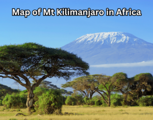
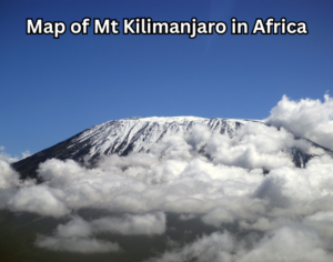
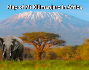
Mount Kilimanjaro is one of Africa’s most iconic natural landmarks, and understanding its geography begins with a clear and accurate map of Mt Kilimanjaro in Africa. Rising majestically in northeastern Tanzania, near the border with Kenya, Kilimanjaro is the highest free-standing mountain in the world and a powerful symbol of adventure, exploration, and natural beauty. A detailed map helps travelers, climbers, and geography enthusiasts visualize exactly where the mountain is located and how its vast landscape is structured.
The map-of-Mt-Kilimanjaro-in-Africa not only shows its position on the African continent but also highlights essential features such as national park boundaries, access towns, climbing routes, and altitude zones. From the popular Machame and Marangu routes to remote paths like Lemosho and Rongai, a map offers crucial insight into how the mountain can be explored. It also reveals Kilimanjaro’s unique ecological zones, ranging from lush rainforest at the base to alpine desert and snow-capped glaciers near the summit.
Whether you are planning a climb, studying African geography, or simply curious about this legendary peak, a well-explained map of Mt Kilimanjaro provides the foundation for understanding its scale, location, and global significance.
Where Is Mt Kilimanjaro Located in Africa?
A map of Mt Kilimanjaro in Africa shows that the mountain is located in northeastern Tanzania, close to the Kenya–Tanzania border. Despite being near Kenya, Kilimanjaro lies entirely within Tanzania and is protected as part of Kilimanjaro National Park, a UNESCO World Heritage Site.
Geographically, Mount Kilimanjaro sits just south of the Equator, which makes its snow-capped summit especially fascinating. On most Africa maps, you will find Kilimanjaro east of the Great Rift Valley and southeast of Lake Victoria, Africa’s largest lake. For More Info Visit Here!
Key nearby locations visible on the map include:
-
Moshi Town (main climbing hub)
-
Arusha City (safari and travel gateway)
-
Amboseli National Park in Kenya
Understanding the Structure of Mt Kilimanjaro on a Map
When viewing a detailed map of Mt Kilimanjaro in Africa, you will notice that Kilimanjaro is not a single peak but a massive volcanic complex made up of three cones:
Kibo
Kibo is the highest and most famous cone, home to Uhuru Peak (5,895 meters / 19,341 feet). This is the summit most climbers aim for.
Mawenzi
Mawenzi is rugged and jagged, visible on maps as the second-highest peak. It is rarely climbed due to technical difficulty.
Shira
Shira appears as a plateau on the western side of the mountain and is one of the oldest volcanic remnants.
Most Kilimanjaro maps clearly label these three features, helping readers understand the mountain’s volcanic origin.
Climbing Routes Shown on the Map of Mt Kilimanjaro in Africa
One of the most valuable aspects of a Kilimanjaro map is how it displays the climbing routes. These routes circle the mountain from different directions and vary in scenery, difficulty, and success rates.
Popular Routes on the Map
-
Marangu Route – Approaches from the southeast; known as the “Coca-Cola Route”
-
Machame Route – Approaches from the southwest; highly scenic
-
Lemosho Route – Starts from the west; excellent acclimatization
-
Rongai Route – Approaches from the north near Kenya
-
Northern Circuit Route – The longest and most gradual path
Each route is clearly marked on professional maps, often color-coded for clarity.
Altitude and Ecological Zones on the Kilimanjaro Map
A high-quality map of Mt Kilimanjaro in Africa also illustrates the mountain’s five ecological zones, which change dramatically with elevation:
-
Cultivation Zone (800–1,800 m)
Surrounding farmland and villages -
Rainforest Zone (1,800–2,800 m)
Dense forest with wildlife and heavy rainfall -
Heath and Moorland Zone (2,800–4,000 m)
Open landscapes and giant plants -
Alpine Desert Zone (4,000–5,000 m)
Harsh, dry, and cold terrain -
Arctic Zone (Above 5,000 m)
Glaciers and snow near the summit
Maps often use shading or contour lines to show these altitude transitions clearly.
National Park Boundaries and Conservation Areas
Another important detail shown on the map of Mt Kilimanjaro in Africa is the boundary of Kilimanjaro National Park. The park covers approximately 1,688 square kilometers and protects both the mountain and surrounding ecosystems.
Maps highlight:
-
Park entrances (Machame Gate, Marangu Gate, Lemosho Gate)
-
Ranger stations
-
Buffer zones around the mountain
This information is especially useful for climbers and researchers.
Why the Map of Mt Kilimanjaro in Africa Is Important for Travelers
For travelers and trekkers, a Kilimanjaro map is not just informational—it is practical. It helps with:
-
Route comparison
-
Understanding daily elevation gain
-
Visualizing camp locations
-
Planning acclimatization days
A good map also helps travelers understand how Kilimanjaro connects with nearby safari destinations in northern Tanzania.
Kilimanjaro’s Position on the African Continent
From a continental perspective, the map of Mt Kilimanjaro in Africa places the mountain within East Africa, one of the most geologically active and scenic regions on the continent.
It sits:
-
East of the Congo Basin
-
South of the Horn of Africa
-
Near major wildlife corridors
This strategic location explains why Kilimanjaro is often combined with safaris in Serengeti, Ngorongoro, and Tarangire.
Read Also: Where Is Kilimanjaro? Discover Africa’s Tallest Peak
Digital vs Physical Maps of Mt Kilimanjaro
Today, Kilimanjaro maps exist in both digital and printed formats.
Digital Maps
-
GPS-enabled
-
Interactive elevation profiles
-
Ideal for modern climbers
Physical Maps
-
Useful for planning
-
No battery dependency
-
Commonly used by guides
Both formats rely on the same core geographic data shown in a traditional map of Mt Kilimanjaro in Africa.
Educational Value of Kilimanjaro Maps
Beyond tourism, Kilimanjaro maps are widely used in:
-
Geography textbooks
-
Climate change studies
-
Volcanology research
-
African environmental education
They visually explain how a single mountain can influence weather patterns, biodiversity, and regional culture.
Final Thoughts
A well-detailed map of Mt Kilimanjaro in Africa is more than a simple illustration—it is a gateway to understanding Africa’s highest mountain. From its exact location in Tanzania to its volcanic structure, climbing routes, altitude zones, and national park boundaries, a map brings Kilimanjaro to life in a clear and meaningful way.
Whether you are planning a climb, studying African geography, or simply exploring the continent from afar, understanding the map of Mt Kilimanjaro gives you a deeper appreciation of why this legendary mountain continues to inspire the world.