
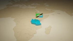
Understanding the map Tanzania and Zanzibar is the first step for anyone planning an unforgettable journey to East Africa. Tanzania is one of Africa’s most diverse travel destinations, known for its vast wildlife parks, iconic landscapes, and rich cultural heritage. Just off the eastern coast of the country lies Zanzibar, a breathtaking island archipelago in the Indian Ocean famous for its white-sand beaches, turquoise waters, and historic towns. When you explore the map Tanzania and Zanzibar, you can clearly see how the mainland and the islands connect to create a unique travel experience that combines adventure and relaxation.
The mainland of Tanzania is home to world-renowned safari destinations such as Serengeti National Park, Mount Kilimanjaro, and the wildlife-rich Ngorongoro Conservation Area. Meanwhile, Zanzibar offers a completely different atmosphere, with cultural treasures like Stone Town and stunning beaches along the island’s coast. By looking at the map Tanzania and Zanzibar, travelers can easily understand distances, key locations, and the best routes to explore both the mainland and the islands. Whether you are planning a safari adventure, a beach holiday, or a cultural exploration, the map Tanzania and Zanzibar provides the perfect starting point for discovering one of Africa’s most captivating destinations.
Understanding the Geography of Tanzania and Zanzibar
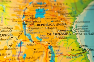
Looking at a map Tanzania and Zanzibar, you’ll quickly notice that Tanzania sits on the eastern coast of Africa, bordered by the Indian Ocean. The mainland is vast and filled with diverse ecosystems—mountains, plains, lakes, and national parks.
Just off the coast lies Zanzibar, a semi-autonomous region of Tanzania consisting of several islands. The two main islands are Unguja and Pemba Island. Unguja is commonly referred to as Zanzibar Island and is home to the famous historic center of Stone Town.
When studying the map Tanzania and Zanzibar, travelers can clearly see that the islands are only about 25–50 kilometers from the mainland. This close distance makes it incredibly easy to combine safari adventures with relaxing beach holidays. For more info visit here!
Major Cities on the Map of Tanzania
A good map Tanzania and Zanzibar highlights several key cities that serve as gateways for travelers.
Dar es Salaam
The bustling coastal city of Dar es Salaam is Tanzania’s largest city and an important travel hub. Many international visitors arrive here before heading to national parks or catching a ferry to Zanzibar.
Arusha
Located in northern Tanzania, Arusha is known as the safari capital of the country. From here, travelers begin their journeys to world-famous wildlife destinations.
Zanzibar City
On the island itself, Zanzibar City serves as the main urban center and cultural heart of the islands.
Seeing these cities on a map Tanzania and Zanzibar helps travelers understand the best travel routes and transportation connections between mainland Tanzania and the islands.
National Parks You’ll Find on the Map
Tanzania is globally recognized for its wildlife and conservation areas. When exploring a map Tanzania and Zanzibar, several iconic parks stand out.
Serengeti National Park
Perhaps the most famous safari destination in the world, Serengeti National Park is known for its endless plains and the spectacular Great Migration.
Ngorongoro Conservation Area
Another remarkable location visible on the map Tanzania and Zanzibar is the Ngorongoro Conservation Area, home to the massive Ngorongoro Crater and an incredible concentration of wildlife.
Mount Kilimanjaro
Africa’s highest mountain, Mount Kilimanjaro, rises dramatically above the surrounding plains and attracts climbers from around the world.
These legendary destinations make Tanzania a dream for wildlife lovers and adventure seekers alike.
Zanzibar: The Island Jewel of Tanzania
When viewing the map Tanzania and Zanzibar, the island region appears like a tropical jewel floating in the turquoise waters of the Indian Ocean.
Zanzibar is famous for its:
-
Powdery white-sand beaches
-
Coral reefs and diving spots
-
Rich Swahili culture
-
Historic architecture
The cultural heart of the island, Stone Town, is a UNESCO World Heritage Site filled with narrow alleys, carved wooden doors, and centuries-old buildings that tell stories of trade, exploration, and cultural exchange.
Exploring Zanzibar feels like stepping into a living postcard where every corner offers breathtaking ocean views and vibrant local traditions.
Why the Map of Tanzania and Zanzibar Is Important for Travelers
For first-time visitors, a map Tanzania and Zanzibar provides essential guidance for planning a balanced itinerary.
It helps travelers:
-
Understand distances between parks and cities
-
Plan safari routes across northern Tanzania
-
Locate ferry routes and flights to Zanzibar
-
Discover hidden coastal towns and islands
Because Tanzania is a large country, having a clear map Tanzania and Zanzibar ensures that travelers can efficiently combine safari adventures with beach relaxation.
Best Travel Routes Between Tanzania and Zanzibar
One of the most exciting aspects of traveling here is the seamless connection between mainland Tanzania and the islands.
Ferry Routes
Many travelers take a ferry from Dar es Salaam to Zanzibar City, which typically takes around two hours.
Domestic Flights
Flights from Arusha or other safari destinations provide quick access to Zanzibar.
A detailed map Tanzania and Zanzibar makes it easy to visualize these routes and plan the most efficient journey.
Hidden Gems You’ll Notice on the Map
Beyond the famous destinations, a closer look at the map Tanzania and Zanzibar reveals many hidden treasures.
Pemba Island
Often overshadowed by Zanzibar, Pemba Island is known for its untouched nature, lush greenery, and incredible diving sites.
Lake Victoria
Africa’s largest lake, Lake Victoria, forms part of Tanzania’s northern border and supports vibrant fishing communities.
Selous Game Reserve
Now known as Nyerere National Park, this massive reserve is one of Africa’s largest protected wildlife areas.
These locations add depth and adventure to any Tanzania travel plan.
Cinematic Landscapes Across Tanzania and Zanzibar
Few destinations in the world feel as visually dramatic as Tanzania. When looking at a map Tanzania and Zanzibar, you are essentially tracing a journey through some of Earth’s most cinematic landscapes.
Imagine:
Golden sunsets stretching across the Serengeti plains.
Snow-capped peaks rising above African savannahs.
Turquoise waves gently touching Zanzibar’s palm-lined beaches.
Every destination marked on the map Tanzania and Zanzibar feels like a scene from a nature documentary or a travel film waiting to be explored.
Best Time to Explore Tanzania and Zanzibar
Understanding seasonal travel patterns is easier when you analyze the map Tanzania and Zanzibar alongside climate zones.
June to October
This is the dry season and one of the best times for safari experiences.
December to February
Warm temperatures and clear skies make it a great time to visit both the mainland and Zanzibar.
March to May
This period brings heavier rains but fewer crowds and lush landscapes.
Each season offers a unique perspective on Tanzania’s diverse geography.
Planning the Perfect Tanzania and Zanzibar Itinerary
A well-designed itinerary often combines several destinations highlighted on the map Tanzania and Zanzibar.
A popular travel plan might include:
-
Safari in Serengeti National Park
-
Wildlife viewing in Ngorongoro Conservation Area
-
Cultural exploration in Arusha
-
Beach relaxation in Zanzibar
This combination creates a perfect balance between adventure and relaxation.
Final Thoughts
A map Tanzania and Zanzibar is more than just a navigation tool—it’s a window into one of Africa’s most magical destinations. From the wildlife-rich savannahs of mainland Tanzania to the dreamy beaches of Zanzibar, every location on the map tells a story of adventure, culture, and natural beauty.
Whether you’re chasing the Great Migration, climbing Africa’s tallest mountain, or relaxing on sun-drenched tropical shores, the map Tanzania and Zanzibar guides travelers through an unforgettable journey. With its incredible landscapes, vibrant cities, and pristine islands, Tanzania continues to captivate explorers from around the world.
For anyone planning a trip to East Africa, studying the map Tanzania and Zanzibar is the perfect first step toward discovering a destination that feels truly extraordinary.